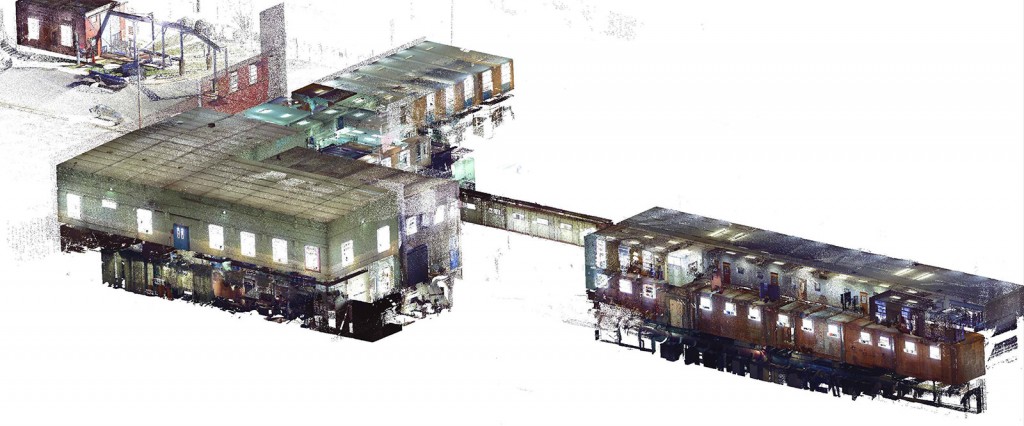
Origin Land Surveying and Mapping, Inc. has been performing 3D laser scanning and spatial imaging services since 2007. (All of our scanning services as well as our data reduction, are performed by a licensed Professional Land Surveyor (PLS).)
- 3D Scanning services include long distance time of flight laser scanning used in mining, roadway, bridge and tunnel design projects as well as phase shift BIM scanning for industrial, mechanical, architectural, civil, environmental, and structural projects.
- 3D scanning can be also be used for historical architectural preservation of buildings and artifacts for future reference, post construction as-built mapping, volumetric calculations, bridge inspection, 3D modeling, generating topographical surfaces for design and analysis, etc.
- Georeferenced 3D and 2 ½ D Orthophotos can be generated to create a visual walkthrough of the scan area for the clients reference and use.Sample scan data can be extracted from these photos and exported for a specific use.
- 3D scanning can be performed on a single object or an entire city block. We have the technology to divide the project into sections or scans to make working with the large amount of data that a scanner generate easier to manage.
- Raw point cloud data can be requested as well as point cloud data with intensity and RGB color values.
- Scanning can be performed using our existing project horizontal and vertical control basis or on an assumed basis.
There are even options for post-processed target-based registration or “real-time” scanning that creates scans that are instantly exportable on your project coordinate system.
Whether you need the detail of a single pump or 10 billion data points for design purposes – we can help!
![outside-elevator-shaft[1]](https://originlandsurveying.com/wp-content/uploads/outside-elevator-shaft1.jpg)
![outside-crane1[1]](https://originlandsurveying.com/wp-content/uploads/outside-crane11.jpg)
![scan-6cb[1]](https://originlandsurveying.com/wp-content/uploads/scan-6cb1.jpg)
![scan-6c[1]](https://originlandsurveying.com/wp-content/uploads/scan-6c1.jpg)
![scan-001[1]](https://originlandsurveying.com/wp-content/uploads/scan-0011-1024x827.jpg)
![pump-1[1]](https://originlandsurveying.com/wp-content/uploads/pump-11.jpg)
